Posted: July 29th, 2008 | No Comments »
These past week, a couple of my follow-up works on the preliminary Tracing the Visitor’s Eye case study based on Florence have been accepted. I will be presenting the position paper “Assessing pervasive user-generated content to describe tourist dynamics” at the First International Workshop on Trends in Pervasive and Ubiquitous Geotechnology and Geoinformation on the need and methods to understand the users practices behind the generation of digital footprints and their relation to the urban space. In addition, the paper “Digital footprinting: uncovering the presence and movements of tourists from user-generated content” will be published in the IEEE Pervasive Computing Magazine, special issue on Pervasive User-Generated Content. It showcases the ability to uncover the presence and movements of tourists from geo-referenced photos they explicitly make public, as well as from network data implicitly generated by users of mobile phones.
Besides encouraging reviews on an “exciting area of research with lots of potential” some comments suggest some areas I should focus my current and future data analysis on:
Reveal the unexpected
- “it would be interesting to hear whether any of the findings were unusual/unexpected”
- “delve deeper into how “digital footprints” provide novel observations/results compared with traditional knowledge (expend to other nationalities)”
- “also focus on people taking photos in their own city (how are they different?)”
In consequence, I am exploring methods to reveal abnormal behaviors from time series, and to profile users from their use of the system and their mobility.
Space and user profiling
- “other automatic group categorization are possible (type of camera?), segmentation of the cellphone data as well”
- “what areas are more prone to be taken with a camera phone than a digital camera? and how does this evolves?”
- “hypothesis: tagged data is likely to be of fairly high quality (accurate and semantically meaningful)”
- “different types of tourists may geocode photos differently (American tourists are much less adept at geocoding location apart from thos most famous landmarks than Italian tourists”
Validation
- “conclusions are conjectures and not yet validated (they are obvious and not too controversial)”
- “methods of validation will likely have to be developed”
- “how to assess the impact of the biases in the data?”
- “in what ways does the passively collected data accurately reflect reality?”
- “additional investigation into the reasons for the discrepancies between datasets seems warranted. Do the demographics of photographers match the demotraphics of the mobile phone users? This additional analysis may help more convincingly explain the validation discrepencies and provide an avenue for correcting biases.”
In consequence, I am collecting hard data from traditional surveys that should represent the reality to compare to and calibrate to if they correlate.
Heterogeneity of the analysis
- “tie more together explicitly each analysis (presence and flow)”
- “are there other types of analysis (besides presence, flow, semantics)”
In consequence, I have to set an exhaustive list of what can be analyzed for each type of digital footprint and digital shadow. Then explain the scope of each type of analysis and how they relate to each other.
In consequence, I have extended the features that characterize users (e.g. type of camera, taken time and upload time difference, categories of tags used, …) in a correlation matrix. Use of proximity function and clustering techniques to define groups of users. Use of Characterization techniques as seen previously in Methods to Study Flickr Users Behaviors.
Posted: July 28th, 2008 | No Comments »
The interdisciplinary project Visualizing Cultural Patterns (see also Visualizing Cultural Patterns and video) was created on the novel opportunities to studying social and cultural processes from large amounts of data about people’s cultural behavior and preferences as well as cultural assets themselves in digital form. In the same vein as Bruno Latour’s essay on digital footprints (and other sources), this project starts from the observation that:
The joint availability of (a) large cultural data sets (through the Web and digitization efforts by museums and libraries) and (b) tools already employed in the sciences to analyze big data makes feasible a new methodology for the study of cultural processes and artifacts. If humanities have typically relied on the manual analysis of a small number of cultural objects, we can now create information visualizations of large cultural data sets to discover patterns that have not been visible previously.
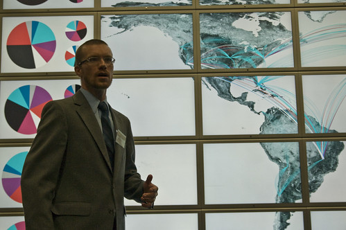
Lev Manovich present interface design for Cultural Analytics Research Environment running on HiperWall. Photo courtesy of Anne Helmond
Relation to my thesis: A growing number of researchers start take advantage of digital footprints . This one proposes an interdisciplinary approach with a combination of expertise in Visual Arts, Communication, Cognitive Science, and Structural Engineering. I am really intrigued by their use of computer-based analysis and visualization of large data sets and data flows used that should go beyond eye-candy mashups.
Posted: July 28th, 2008 | No Comments »
Autodesk officially launched their Digital Cities initiative with a first pilot in Salzburg. Their approach relies on a shared 3D collaboration and visualization environment for data from architectural models, utility networks, transportation networks. The aim is to foster a holistic approach to city management from engineering-level models to visualize, analyze, and simulate the real world. In an interview on the initiative, Doug Eberhard, Autodesk’s senior director for digital cities highlights the importance of this approach to communicate early in project:
The current process has been called the DAD method (decide, announce, defend), but that’s changing. By communicating early and often, you eliminate a lot of backlash. Digital cities allow you to share projects with the public in a robust and meaningful way.
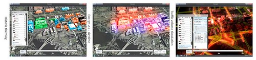
Snapshots of the Digital Cities Metropolis demos
Update: Doug Eberhard “Digital Cities” presentation at Where 2.0.
Relation to my thesis: A corporate vision on the management of hybrid cities (see also Arup’s Future of Connected and Sustainable Cities). I wonder if the move from 2D to 3D and 4D provides better perspectives to collaborate and take decisions. From my experience, novel urban visualization based on more social data than the ones handled by Autodesk have a real added-value for local authorities to communicate and reveal some invisible aspect of a city (such as in Florence). However, the fluctuating quality in the data often still not taken into consideration in the visualization often prevent from decisions to be taken. Bad or missing data also come from the current unsustainable digital practices in cities. I have noticed several time that agencies don’t share information or we share it in unsustainable ways.
Posted: July 21st, 2008 | No Comments »
I stumbled upon this video of Eric Rodenbeck’s presentation at Postopolis! who chronologically describes Stamen’s projects (see also Dan Hill’s notes and a past presentation with Tom Carden on Visualizing Urban Data). In Mappr, they experimented the geottaged photos on Flickr to extract meaing from the tags that contain location information (representing 40% of the tags by then). For instance Route 66 draws itself from the rich dataset. Along the same vein, in a recent presentation at MIT, (ex-)Yahoo! Research Berkeley Mor Naaman employs the same “Route 66″ example to show emerging patterns from a social media perspective (see slides How Flickr Helps us Make Sense of the World)
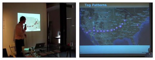
The Route 66 example, Eric Rodenbeck (left), Mor Naaman (right)
Relation to my thesis: I have certainly inspired from from Stamen projects on visualizing urban data and Yahoo! Research Berkeley legacy on the studying geotagging practices and extracting patterns from the data, even though eventually we do not share the same goals.
Posted: July 19th, 2008 | No Comments »
Whenever I introduce the domain of “urban computing” I mention three highly intertwined themes. First the design of technologies that integrate into the urban environment (still) driven by ubicomp-optimists; second the study of impact of these technologies on the city observed by social scientists and human geographers; and third the research on revealing the invisible urban dynamics led by hybrid groups of individuals with architecture, design, urban planning, GIS, social sciences or computer sciences backgrounds. Two major drivers of this this theme are the emerging and massive availability of georeferenced data and the popularization of mapping softwares (not to say GIS). Kazys Varnelis and Leah Meisterlin’s essay “The invisible city: Design in the age of intelligent maps” exemplifies very well these new opportunities for designers to describe cities in a novel ways. Yet, this text shows a confusion the novel map previously uncollectible and inaccessible data to the possibility to produce “intelligent maps” (the urban computing version of the ubicomp’s “intelligent fridge”?). It overlooks some critical considerations that the current state of “mash-ups” is still trying to figure out: 0. What part of reality the data reveal? 1. What we can do with them? 2. How to communicate them for people to acquire information (still a far stretch from “intelligent”).
My own “Let’s map and see…”
Relation to my thesis: As much as ubicomp’s vision has been driven by the emergence of mobile, wireless and sensors technologies, I notice that part of the urban computing vision are driven by the newly available data, with a “let’s map and see” trial and error approach rather than starting from human and urban considerations. Of course, my work has not been completely foreign to that, but the clear current steps are about exploring points 0. et 1. They were discussed this Spring at the Real-Time Cities Round Table.
See also Nicolas’ “Design in the age of intelligent maps”
Posted: July 15th, 2008 | No Comments »
This week’s LBS360.net podcast “You are a Sensor” discusses volunteer geographic information and “taking advantage of people doing what they do” to detect diseases, natural disasters, traffic jams, and zones of social activities.
Researchers have determined that you, even without a portable device can be an effective geographic sensor. This week we explore examples of how individuals, sometimes along with their electronic gadgets, can act as effective sensors for disease or natural disaster. Our editors share some proven techniques and explore how this type of data collection might play out in the future.
Relation to my thesis: “human as sensors” getting mainstream
Posted: July 15th, 2008 | 1 Comment »
In addition to the nitrogen tanks, this formidable display in downtown Manhattan is a reminder that the costs of a network are associated with this traditional, messy business of getting it into the ground in highly congested urban areas (source Stephen Graham’s “Beyond the ‘dazzling light’: from dreams of transcendence to the ‘remediation’ of urban life“). A fact often overlooked in the visions on ubiquitous cities that barely consider that virtual flow still require the construction and maintenance of complex physical infrastructure (discussed by Phil Hubbard and the Infrastructure theme of Sliding Friction)
“A holistic, trans-disciplinary and robust understanding of the city as a critical amalgamation of infrastructure networks is required if we are to understand the relations between cities and technologies (and the ever-attendant threat that this relationship will break down if networks fail)” Phil Hubbard
Posted: July 9th, 2008 | No Comments »
Straight from my inbox, a few academic events to keep an eye on:
Social Interaction and Mundane Technologies in Everyday Life.
Theme Issue of Personal and Ubiquitous Computing – Planned publication June 2009
This theme issue is responding to the proliferation and developing constellations of ‘social’ and ‘mundane’ technologies in people’s everyday lives. We define ‘mundane technologies’ (Graham and Rouncefield, 2007) as those quite unremarkable technologies that, given the context in which they operate, have been ‘made at home’, have become ‘ordinary’ and, indeed, part of the organisation already in place (Sacks, 1992). These technologies are often simple, minimalist and ‘loose’ and yet support richly layered social interactions which are sustained and develop across time, place, and culture in particular ‘social worlds’ (Strauss, 1978). Our assumption is that these ‘mundane technologies’ are at a mature level of adoption, with seemingly well worked-out affordances so that their use has become so tightly entwined with activity and social interaction as to be almost invisible (Weiser, 1991) and thus, difficult to study and to be surprised by.
Automated Journeys
Workshop at UbiComp 2008
Computing technology now pervades those moments of our day when we move through our cities. Mobile phones, music players, vending machines, contact-less payment systems and RFID-enabled turnstiles are de rigueur on our daily journeys. This workshop aims to examine these augmented journeys, to reflect on the public, semi-public and private technologies available to us in them, and to speculate on what innovations might be to come. Taking as our starting point cities such as Seoul, we aim to take seriously the developments in mobile technology as well as the advancements in autonomous machinery and how these mesh with our urban journeys.
Collocated social practices surrounding photos
Special Issue of International Journal of Human-Computer Studies – Targeted publication November 2009
Following the uptake of digital cameras there has been considerable interest from the HCI field in contemporary photographic practices. Recent studies on people’s interactions with printed and digital photos have drawn attention to the novel social practices that continue to emerge in light of technical advances. The ways in which people approach the capture, sharing, storing and display of photos are rapidly changing, and the scope of these changes, along with their social and cultural implications, raises interesting challenges and possibilities for the design of supportive technologies. This special issue aims to build on what has become an established corpus of HCI studies on photography, reflecting past research and bringing together recent technical developments, empirical studies and thoughts on method and theory.
ENTER 2009 – 16th International Conference on IT and Travel & Tourism
IFITT’s Global Travel & Tourism Technology and eBusiness Forum
January 28th – 30th, 2009, Amsterdam, Netherlands
Telecommunications and Travel Behavior Committee of the US Transportation Research Board
The TRB Committee on Telecommunication and Travel Behavior invites papers on a wide range of topics related to the understanding, modeling, and analysis of the interrelation between telecommunications and traveler behavior. We are interested in a broad range of issues relating to the role of emerging technologies and travel, but particularly for the 2009 conference, we are seeking papers addressing the following issues.
-Role of Network Attributes on Telecommuting
-Role of ICT in influencing social networks and the travel implications.
-Role of Information and Communications Technology (ICT) on Value of Travel Time
-Role of Information and Communications Technology (ICT)on Leisure Activities
-Geographical and Occupational Clustering of Telecommuters
-The evolving nature of use of Internet and travel implications
International Workshop on Urban, Community, and Social Applications of Networked Sensing Systems
November 4, 2008, Raleigh, North Carolina, USA – Held in conjunction with ACM SenSys 2008
At the same time we are seeing sensors installed in urban environments in support of more classic environmental sensing applications, such as, real-time feeds for air-quality, pollutants, weather conditions, and congestion conditions around the city. Collaborative data gathering of sensed data for people by people, facilitated by sensing systems comprised of everyday mobile devices and their interaction with static sensor webs, present a new frontier at the intersection between pervasive computing and sensor networking. This workshop promotes exchange among sensing system researchers involved in areas, such as, mobile sensing, people-centric and participatory sensing, urban sensing, public health, community development, and cultural expression. It focuses on how mobile phones and other everyday devices can be employed as network- connected, location-aware, human-in-the-loop sensors that enable data collection, geo-tagged documentation, mapping, modeling, and other case-making capabilities.
International Workshop Sensing a Changing World
November 19-21, 2008 – Wageningen University, The Netherlands
Current developments in sensor technology provide increasing opportunities to analyze human behavior and monitor environmental processes in a changing world. However, the challenge will be to develop concepts and applications that can provide timely and on demand knowledge to end-users in different domains and at a range of scale-levels. This workshop has the objective to elucidate common concepts for sensor network applications on aspects like data communication, processing, standardization, knowledge discovery, representation, and visualization.
See previous list of Events, Seminars, Workshops on the City, Space and Socio-Technical Systems
Posted: July 9th, 2008 | No Comments »
A couple of weeks ago at the ICING (Intelligent Cities of the Next Generation) workshop my presentation followed the keynote by Ju Young Byun on the visions and projects in New Songdo, Korea (video of the project). While this Korean master plan is necessary to stretch our imagination, I could not resist in thinking that “Next Generation Cities” are about the “sustainable chaos”, a feature that New Songdo aims at eliminating with technological progress. Understanding the hybrid city of the future obligates not only a trip to the “ubiquitous city” of New Songdo, but also to observe the perpetually collapsing Naples. In other words, quoting Phil Hubbard in Hybrid City:
New technologies do not drive urban change, but are rather caught up in complex networks (or ’socio-technical assemblages’) which incorporate all manner of actants.
it echoes quite well with Mike Crang’s Urban Morphology and the Shaping of the Transmissible City (via Nicolas)
Indeed visions of the city in accelerated time-space very often assume the desirability of instantaneity and speed, in the ‘real-time city’. Robins (1997) has called for a revaluation of Byzantine complexity, and social complexity rather than transparency in thinking through the city – rather than the often unthinking celebration of ordered, purified digital space that is somehow friction-free and the assumption that the absence of dirt and disorder is a good thing.
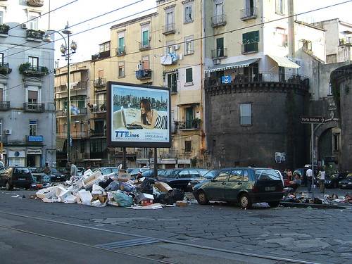
Arguably Napoli is a symbol “Next Generation” city, in strong contrast to New Songdo’s polished vision. Photo courtesy of LHOON
Posted: July 9th, 2008 | No Comments »
After the popular success, some bike sharing systems still suffer from growing pains due to uncertain availability of the service throughout the days and seasons (previously exposed in Barcelona and Paris). The issues have been highlighted in the media these past months such as the official request to perform an external audit of Bicing in Barcelona, and in C’est une impression ou on ne trouve plus de Vélib’ le matin? the list of complains related to Velib’ in Paris. There are several efforts in improving the systems by the providers (JCDecaux and ClearChannel), the local authorities, the users themseves (e.g. from their ideas and mashups) as well as other independent stakeholders in the forms of think tanks (e.g. Espace des Temps in Lyon or The Commons) and “mobility operators” (term inspired by Thierry Marcou) such as Telefonica R&D and their Bicing Usage Survey. Nevertheless it makes me wonder whether they really go beyond the traditional methods of urban and transportation planning. There might be new practices inspired from the worlds of interaction design, evidence-based urbanism and software engineering when it comes to envision and design hybrid urban systems mixing physical artifacts and digital information.
Why do I blog this: Doing some background research on the state of bike sharing systems, for an article (slightly outside the scope of my thesis) on mixed methods research to design future sustainable transport systems based public forms of private transport.