Posted: July 31st, 2007 | No Comments »
It is called “Towards Reducing the Social-Technical Gap in Location-Aware Computing” and the abstract goes as follow:
Abstract: Along in their history, humans never ceased to create techniques and tools for observing their environment and locate themselves in the physical environment. This attests our necessity to be aware of who and what is where and when – a concept that we term location awareness. Nowadays, the democratization of mobile and wireless technologies increases people’s awareness of their whereabouts. However, it also their interaction with the physical environment and by consequence impacts the social interactions and work practices.
Building ubiquitous applications that exploit location requires integrating underlying infrastructure for linking sensors with high-level representation of the measured space to support human activities. However, the real world constraints limit the efficiency of location technologies. The inherent spatial uncertainty embedded in mobile and location systems constantly challenges the coexistence of digital and physical spaces. Consequently, the technical mechanisms fail to match the highly flexible, nuanced, and contextual human spatial activities. These discrepancies generate a social-technical gap between what should be socially supported and what can be technically achieved. This thesis contributes to the research in the field of Computer Supported Cooperative Work (CSCW) and ubiquitous computing by exploring, and hopefully reducing this gap in the context of location-aware systems.
Our preliminary work reports on complementary studies of some of the aspects of the social-technical gap. This preliminary and current work, takes very different perspectives on the use of location-aware applications. These views highlight the role of the spatial context and technological limitations in the use of the systems features. First, we explored the impact of the technical limitations in collaborative tasks experienced in the form of a location-aware game. It allowed us to define the sources of spatial uncertainty perceived by the users while interacting with the system. Then, we investigated the social requirements of linking information to space. In particular, we report on the influence of space in the use of location granularity to share and retrieve photos. Finally, we describe an ongoing ethnographic study of the evolution of taxi drivers practices with the introduction of location-aware and navigation systems in their work. This work reveals the ways positioning technologies influence the work practice of mobile workers. For instance, some drivers access the geospatial information as in a “funnel”. They start a ride with a general idea of an area surrounding the destination. As they enter the targeted area they access detailed information for the specific destination with location-aware application.
The extensive review of the domains of ubiquitous computing and CSCW shows that more of the research in those fields focus on optimizing the accuracy of location sensing and providing seamless interaction. On the other hand, limited work has been pursued to understand the social-technical issued in real-word settings and provide solutions to match the visions of supporting people’s everyday life activities. In consequence, we suggest research perspectives that should contribute to this agenda. Through real-world field studies, we aim at providing solutions for the design of collaborative location-aware systems that take into account the spatial uncertainty inherent to ubiquitous technologies.
Keywords: location-aware computing, spatial uncertainty, CSCW, location-awareness.
Relation to thesis: More than half-way through the PhD… I hope.
Posted: July 26th, 2007 | No Comments »
7.5th Floor now takes part of the newly created LIFT lab’s “/think” publication platform. The idea launched by Laurent Haug is to join the forces of people writing, reporting and thinking on technology and society and put them under the LIFT lab umbrella. LIFT lab is a network-based company that provides among other things, the LIFT series of events, consulting services and publications. Other blogs are gathered under this umbrella with Nicolas’ Pasta &Vinegar as flagship.
7.5th Floor will remain dedicated to reporting my readings, thoughts and milestones as part of my PhD thesis on the socio-technical gap in ubiquitous location-aware computing.
Many thanks to Luc (to whom I owe several diners in his favourite Zürich restaurants) for hosting this bazar from the beginning.
Posted: July 19th, 2007 | 3 Comments »
IEEE Pervasive Computing special issue on Urban Computing is out. The guest editors Tim Kindberg, Matthew Chalmers, and Eric Paulos define urban computing as “the integration of computing, sensing, and actuation technologies in everyday urban settings and lifestyles“. The urban space is a recent ground of investigation because it poses many specific research and deployment challenges: as ownership issues are complex as are the dynamics and density of system participation. Successful integration requires taking several facets of the environment into account at once. Urban settings frame social behaviors. They encompass architectural forms and features that might not be harmonious with given technologies, and they’re variably permeated by wireless networks and fixed and mobile devices.
Urban computing research is still at an early stage with a wide range of opportunities. They range from understanding urban appropriation of pervasive technologies, to producing fully integrated designs specifically for urban settings, and taking advantage of the deployed technologies to augment the understanding of the urban environment. My contribution (in collaboration with Nicolas) to this issue lies in the last category. We briefly describe as a Work in Progress the Tracing the Visitor’s Eye project in which we collect Flickr photos to reveal the movements of people in cities.


Tracing the Visitor’s Eye in Rome
Relation to my thesis: Urban computing is an emerging research avenue at the crossroad of ubiquitous computing and HCI. Definitively a sweet spot of my research focus.
Posted: July 17th, 2007 | 2 Comments »
My work-in-progress submission entitled “Place this Photo on a Map: A Study of Explicit Disclosure of Location Information” has been accepted to the 9th International Conference on Ubiquitous Computing, 16-19 September 2007, Innsbruck, Austria.
Abstract. This paper reports on the early results from an ongoing study of the use of popular photo-sharing platform. We specifically focus our investigation on the factors influencing the accuracy users choose to link their photos to the physical world. We believe that modeling these mechanism can impact the design of ubiquitous systems that support sharing and retrieval of location-enhance information. For instance, it could suggest guidelines to match people’s expectations of granularity in location information. Our early results reveal that while familiarity with a place does not seem to influence the accuracy of the disclosed location, the city and type of urban landscape impact the use of coarse and fine-grained location information.

The reviewers’ feedback are positive about the pertinence of this work and the approach. They mention “relevant to ubicomp”, “the concepts and the writing are generally good”, “the problem is important and the early findings are interesting”, “good problem formulation and research methodology”, “the authors have taken the proper first steps by looking at a real-world data set”. However, they question the early analysis:
- I concentrate on how people tag, rather than what is actually done with those tags. So I won’t be able to know about the usefulness of granularity.
- More depth analysis and logic should be supplied to make the Barcelona results believable.
- Application of arbitrary boundaries (why 2 months to seperate between resident and tourists. I could have let the categories emerge.
- Why familiarity with the environment was the only metrics chosen.
- Some more depth to the results, even in a few more sentences
- The results might be strongly tied to Flickr, thus I need to validate the findings by cross-checking different platforms.
Relation to my thesis: A final extended abstract to help me validate Tracing the Visitor’s Eye.
Posted: July 13th, 2007 | No Comments »
Posted: July 5th, 2007 | 3 Comments »
News views using the statistical and graphical tool R for my Tracing the Visitor’s Eye project:
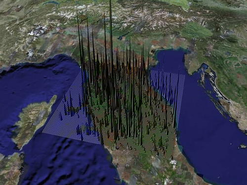
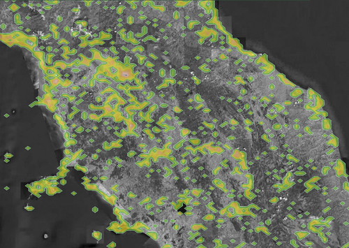
Relation to my thesis: I am developing a spatio-temporal data analysis tool to study how people use location (e.g. the information granularity) and location-aware applications (managing the uncertainty). I work with R to lose the dependance to GeoIQ and GeoCommons. They have been nice platform to quickly work on proof of concepts, but I know need a greater control on the algorithms I select. Next steps would be to replace Google Earth with an integration of Processing and the InfoScope
Posted: July 4th, 2007 | No Comments »
In Web 2.0 and beyond – changing the map, anywhere, any device Eamon Walsh describes the basic concept of ICING of providing two-way communications between the citizen and government. The facilities developed in ICING include reporting on issues such as uncollected garbage, or just opinions positive or negative on new parks, etc; collating all this data, analyzing it, and reporting it back to the public, such as in “City Affection Maps”.
There are similar, more humble, projects to provide the ability for citizens to locate the problems they face in their daily lives. For instance, Innaccessible Barcelona provide physical impaired persons with a mobile phones to photograph every obstacle they come across or FixMyStreet, let people report problems with the street system around where they live. Those are rather compelling scenarios. However, very little (or no) platforms with location as source of communication have reached a scale exceeding a limited amount of citizen (to the exception of platial?). Despite the lack of success, there are still major projects such as ICING or WikiCity that partially assume that spatial annotation is a natural process for a citizen. Moreover, there are limited reports describing the failed studies of spatial annotation. The only one I am familiar was presented at this year’s CHI Mapmover: a case study of design-oriented research into collective expression and constructed publics. More analysis of failures might help revealing the driving factors that would make citizens annotate their city and therefore create engaging location-based systems.


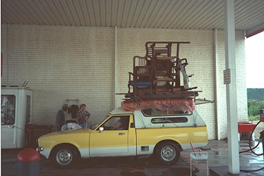
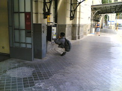
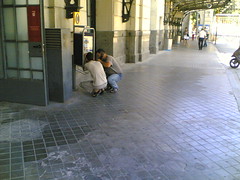
Poetically dumped mattresses located with FixMyStreet (left) and providing evidences of accessibility issues of a store in Barcelona (right).
Relation to my thesis: Observing the emerging applications based on location and location technologies in urban environments and wondering about the factors that can engage citizen to attach information to a location. (+ embracing the constant repair state of a city)
Posted: July 4th, 2007 | No Comments »
After the Economist in March in “Go With the Flow“, this weekend the French newspaper Le Monde published almost a full page on the Massachusetts Institute of Technology SENSEable City Lab Real Time Rome project “Nous savons combien vous êtes !” while the BBC news covered the current lab WikiCity project in “Beating congestion with mobiles“.
Relation to my thesis: I will join this fun group of cool cats for my 3rd year of PhD.

