Posted: September 24th, 2009 | No Comments »
Today I participated to the My Map is Not Your Map Workshop at Arteleku in hype and laid-back San Sebastian. The workshop gathers an enriching mix of artists, designers, academics, engineers. My 45min talk “New maps and practices of hybrid spaces” aimed at describing the new types of maps of hybrid spaces, their utility and their integration into practices from tourism and urban studies to the wayfinding practice of taxi drivers. Comparing to traditional maps, I stressed the increasing value of the 4th dimension (time) in the dynamic and interactive representation of hybrid spaces now available, taking the occasion to provoke the audience with the notions of “real-time awareness” and “end of the ephemeral”. Indeed, not only these new maps alter our immediate apprehensions of the space we feel, live and work in, they also serve as means to communicate evidences and measurements, critical to evaluate space management strategies and policies. These approaches could alter the practices that relate to physical character of the world and human activities. However, part of the evolution of these new practices, we should consider their implications in forms of trade-offs and amputations.
The audience reacted to the notion of “imperfect mirror to reality” (information granularity, spatial uncertainty, seamful design), I believe capturing quite well the limitations of the kind of work I develop. I like to use these practical aspects, around the notion of oligopticon to balance any rhetoric that portrays the “perfect surveillance system”.
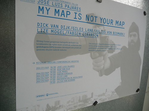
Thanks to José Luis Pajares for the invitation!
Posted: September 17th, 2009 | No Comments »
The First International Forum on the Application and Management of Personal Electronic Information will take place next month in Cambridge, MA. It is part of the Engaging Data initiative recently launched by the MIT SENSEable City Lab which seeks to address the issues surrounding the application and management of personal electronic information. The goal of the forum is to:
To explore the novel applications for electronic data and address the risks, concerns, and consumer opinions associated with the use of this data. In addition, it will include discussions on techniques and standards for both protecting and extracting value from this information from several points of view: what techniques and standards currently exist, and what are their strengths and limitations? What holistic approaches to protecting and extracting value from data would we take if we were given a blank slate?
The event will gather participants from multiple domains, including watchdogs and activists (see Program and Speakers), to debate on the major challenges of exploiting personal electronic information (e.g. Mining the network, extracting social value from personal data, best practices and standards, understanding the benefits versus expectations of users, …).

Why do I blog this: Lift lab is setting up a workshop for the Urban Labs gathering on the similar issues, with a practical focus, grounded on concrete projects (i.e. concrete datasets, concrete space of action, concrete actors). Beyond its many merits, I find the name of the “Engaging Data” initiative rather misleading, as we need to go beyond the stage of using data to engage. Taking the parallel with the many open data initiatives, after a rather short period excitement, there is now a need to measure the utility of exploiting these data (see Mesurer les résultats de la libération des données). Indeed, beyond the necessity to agree on the best practices, from transparent processes to the data protection, obfuscation and cloaking techniques, there will be soon a demand to prove their objective and subjective positive impacts (e.g. ROI, better awareness, improved services, improved public space design, quality of life). Now, the definition of criteria to measure this success is probably one outcome of the Urban Labs workshop.
Posted: September 9th, 2009 | 1 Comment »
The paper Detecting air travel to survey passengers on a worldwide scale (pre-editing version), co-authored with Pierre Dillenbourg and Nicolas Nova, as been accepted for publication in the Journal of Location Based Services. It reports on a methodology for gathering mobility data at a world-wide scale, contrasting with traditional travel survey methods. The originality of this research work is to take into consideration the limitations of the technological settings as well as the complexity of human and technological environments as the source of the design solution.
Abstract. Market research in the transportation sector is often based on traditional surveys, such as travel diaries, which have well documented shortcomings and biases. The advent of mobile and wireless technologies enables new methods of investigation of passengers behaviour that can eventually provide original insights into mobility studies. Because these technologies can capture travellers’ experience in context and real time, they pave the road for new surveys methods. In this paper, we demonstrate that mobile phones can recognize air travel with a light algorithm that scans their connectivity to cellular networks. The originality of our method is that it does not rely on any GPS-like location information and runs on a large variety of mobile phones. It detects flights on a worldwide scale and asks travellers to report on their travel experiences as they occur, eliminating the recall bias of traditional solutions. Once the system detects a journey, it triggers a flight satisfaction questionnaire that sends answers to a centralized server. This approach respects the traveller’s privacy and proved a 97% success rate in detecting flights in a 12-months study involving 6 travellers who boarded on 76 planes.
Keywords: Sensing and activity recognition, mobility detection, transportation study
Unlike the traditional ways to capture travel information, our approach relies on the mobile phone to generate “automatic passive” GSM fingerprints and trigger an in-situ questionnaire. It is an hybrid solution of implicit motion detection with the air traveller’s consent and explicit disclosure of the travel experience. The motion detection is based on an algorithm that analyses the sequences of GSM network Location Area Identity. The figure below shows 3 examples: In flight, the mobile phone roams from one country code to another. If our software does not retrieve any LAI within 30 minutes, it detects an air travel. In a train, the mobile phone moves within different network providers and area codes. No survey appears if the disconnection periods do not exceed 30 minutes. Similar scenario takes place for a car that moves within different location areas.

Why do I blog this: Work conducted a couple of years ago as a fruit of the research developed for CatchBob! at the demand of a client of Simpliquity. Unlike many designs that consider practical constraints as detrimental to the elegance of technological solutions, we instead viewed them as opportunities to rethink solutions which eventually have to change over time.