Posted: July 16th, 2010 | 3 Comments »
For the HABITAR exhibition, we wanted to augment the catalogue of design scenarios with essays that challenge and explain the new practices, tools, solutions and languages that are being developed to negotiate the near future of cities. With an objective of transdisciplinarity with the language of architects as a backbone, each contribution meant to participate to a common dialogue with a unique perspective. I believe it worked quite well, so I strongly encourage you to read them downloading (pdf) or purchasing (5.00€) the catalogue.
Here is brief – overly summarized – overview of the essays and their articulations as part of the script José Luis de Vicente and I had planned.
“Urban Software: The Long View” by Molly Wright Steenson
First, we wanted an historical account of the concept of urban intelligence that resonate in many of the contemporary discourses. Right at that time Molly Wright Steenson had contributed to the Microsoft Social Computing Symposium with an “introduction of computing to urbanism and urban planning”. Molly kindly agreed to synopsize her talk and investigation in that domaine. In “Urban Software: The Long View”, she describes the emergence of active forms of intelligence from the distribution of information and commands for interaction (starting with the development of intercity railroad and electrical telegraph) and new procedures (software with the information and feedback flows they generate):
The concept of urban intelligence overlaid upon a city is much older than one might think. It originates in the 1830s in the symbiotic development of intercity railroad and electrical telegraph. The railroad made it possible to quickly deliver both passengers and written communication over long distances; the telegraph, whose wires followed rail lines, facilitated nearly instantaneous long-distance communication. The result was no less than the distribution of intelligence. In 1850, science writer Dionysius Lardner wrote, “The Electric Telegraph for the transmission of intelligence, in the most literal sense of the term, annihilates both space and time.” The telegraph, in Lardner’s view, rendered moot concepts of geography, distance, duration, and tempo. It altered all of the possibilities for connectivity and shifted society’s expectation for information. The diffusion of knowledge over space and time—the “transmission of intelligence” to which he refers—would cause “the increase of civilisation by intellectual means.” The new mobility provided by communication was tantamount to the growth of intelligent society. Telegraphy, in his view, was a system for distributing culture.”
This perspective of a world constructed of information and feedback flows naturally seeped into architecture and the design of cities, leaving computer scientists and architects wondering about “Life in a Computerised Environment”, with concerns on the the particular lack of adaptability of computerized systems that are poor at handling sudden changes in context in environments and concerns in ways of dealing with physical reality:
Software exists to make sense of information in the world—including organic information. This cybernetic perspective, of a world constructed of information and feedback flows, does not stop with machines and people: it seeps into architecture and the design of cities. “By and large, these alterations have been internal, in the form of new procedures and ways of dealing with physical reality, rather than purely visual responses,” writes Burnham. It’s not just that which is read that concerns Burnham, but how the procedures and the societal changes instigated by information affect the day-to-day reality of physical inhabitation. It is the possibility of intelligence—of information being taken into account by urban systems and thus changing the interaction of a city’s residents.
Some of the the intelligent systems exhibited at HABITAR annihilate conventions produce a radical shift in the notions of time and space, leaving Molly wondering on the combination of people behaviors and cities mediated by software:
Intelligent systems, in short, annihilate convention. They introduce a radical shift, whether in time and space, as with the telegraph, or in procedures and information—software and data—that Burnham described. If we magnify Ted Nelson’s statement, “Our bodies are hardware, our behavior software,” how do our bodies meld with our cities, mediated by software? And just what might our cities learn from us?
“Building a Useful City of Bits” by Bryan Boyer
The building of cities and the bringing of technology to life should have led to a natural convergence in the architects/designers and technologists practices. However, to the exception of some pioneer works the cross-disciplinary combination of deep expertise in technology and spatial design remains highly uncommon. Being an active actor in both worlds, Bryan Boyer has been vocal about the antagonism of practices. We invited him the explain the promises of cross-disciplinary work to help “Building a Useful City of Bits”.
Even with large body of work in the community of technologists to dissolve information with a vast quantity of output media and the banality of digital production equipment in architecture schools and ateliers, we are still left wondering “What urban informatics is actually instrumental in solving?”
Efforts to combine these two fields have yielded modest results: technology happens to exist in the city, such as the digital screens now dotting many central business districts, and buildings happen to have some technology glued on to them, here and there an LCD facade. The more that practitioners on both sides of this divide actively engage, understand, and recombine each others’ working modalities—rather than just the output formats—the better the outcome will be. The attention-grabbing aspect of cross-disciplinary collaboration may be its outward expression or formatting, but the transformative potential is in finding hybrid working models.
Cross-disciplinary works becomes key to finally demonstrate that urban informatics is a worthwhile endeavor at an urban scale. Bryan has been active in setting up projects involving the expertise in technology, architecture, interaction, space and finance:
The C_Life team, bringing together expertise from the fields of architecture, urban design, finance, construction, real estate, technology, and informatics, recently signed a contract to build the Low2No block, which has a projected completion date in late 2013. With a serious investment demonstrating a mission-driven commitment to support informatics as part of a large scale development project, Low2No is one answer to the question of financing. With a little luck, in three years time the key question of, “What are informatics instrumental in solving,” will have a sketch of an answer.
“Notes on the Design of Participatory Systems – For the City or For the Planet” by Usman Haque
Other practitioners at the frontier of architecture/design and technologies have explored other forms of cooperation with the involvement of the many actors of the city. Usman Haque has been active in building participatory systems (see his Lift France talk on Chaning Things). He agreed on illustrating the paradoxical structures of collaboration and the ways that the paradoxes can be harnessed. He particularly highlighted 10 key elements in the design of participatory systems (here overly summarized):
- Dilemmas: you cannot rely on the end goal being incentive enough to encourage individuals to participate and cooperate on achieving the end goal.
- Incentives: a participatory system needs to have intermediary, short term incentives from which participants can gain tangible benefits
- Increments: incremental participation results in incremental gains; they cannot depend on an “all or nothing” situation.
- Trust and evidence: trust largely comes from evidence; and self-constructed evidence is the best of all because it does not require second-hand knowledge.
- Tools for evidence: determining indicators for success is crucial
- Opting out: the choice of “opt out” must not be made into a value judgement by thos who “opt in”.
- Granularity: in any participatory system there will be those with different skillsets, different responsibilities, different desires, different commitment levels and different time-availability.
- Coupling: rather than trying to develop solutions to individual problems, construct means for incremental incentivised actions in two seemingly unrelated domains to benefit each other.
- Complexity: it it’s that complex, it means it’s beyond professional capabilities of any single individual: it *demands* cooperation. […] a designer is there to ensure that that goal is *not fixed* but can be overridden by participants.
- Public spectacle: if a public spectacle is engaging, it encourages people to observer, ask questions, occasionally even participate.
“The Gifted City: A Design Concept” by Anne Galloway
Technologist, architects and designers envision special or even superior kind of cities, gifted in their abilities. But also gifted because they are being given as gifts. It is this theme of the gifted city that Anne Galloway presented last year at Lift in Geneva. Unfortunately, there is no video archive of her talk, so we thought that HABITAR provided an extra opportunity to capture her thoughts on the relations between the designers and consumers/users of sentient and reactive environments.
The gifted city instantaneously connects us to others near and far, places us where we need or want to be, maps our activities in real-time and captures information for our later action. The gifted city promises that we can become gifted individuals.
These new products and services can also be seen as gifted objects or abilities, in the sense that they have been given as gifts.
The ideal gift does not establish a relation of obligation but instead, as it happens in our everyday lift, opens up imminent relations between subjects, expanding these relations to other forms of exchange and becoming. But there are also gifts the we do not want, need or understand, of course raising complex implications in the design of gifted cities with its services and objects:
The gifted city I have conjured is an extraordinary city given to us by well-intentioned designers. But my conceit raises more questions than it provides answers and I wonder what kind of gifts and gift-relations we are creating. What happens to the cities and people that do not receive our gifts? Are our gift-relations free from obligation, or do we expect something in return? Do we design with ourselves in mind, or others? Do we design for abstract users and scenarios, or for concrete people, situations and affects? Do we give gifts that expand possibilities and open up space for new relations, or do we reinforce existing affiliations? Can our gifts only be used in particular ways, or can people use them as they wish?
We know that gifts and gift-giving involve complex, and sometimes even fraught, values and activities. But they also involve fundamentally caring relations, and with each gift we create we too are given something: the opportunity to create a richer, more meaningful gift. So what kind of city would you like to give and what kind of city would you like to receive?
“Snapshots From a Fictional Asynchronous City” by Nicolas Nova
Nicolas Nova further questions the content of these gifted cities and their emphasis on instantaneity and real-time as a limiting metaphor, a thought he started to frame in the pamphlet A synchronicity: Design Fictions for Asynchronous Urban Computing he wrote in company of Julian Bleecker. In “Snapshots From a Fictional Asynchronous City”, further exemplifies his critique of the obsession on the present and the ephemeral:
Moreover, the focus on instantaneity in this Urban Informatics projects often leads to a relative absence of consideration towards other temporal dimensions. Designing meaningful and original new media experiences may considerably benefit from a more complex understanding of time.
From his critique, he describes project that go beyond the conventional assumptions about digital experience of space. For instance the Slow Messenger, developed at the Near Future Laboratory in company of Julian Bleecker, that provokes on the spirit of a affinity from pre-digital correspondence. Similarly, Jotyou is a communication system that enable people to send message in a potential future without knowing when a message can be read, only where. These projects show the opportunities in pushing the envelope of the “real-time meme”.
What these various projects show is simply that there are intriguing ways to go beyond the “real-time meme” that pervades current instantiations in Urban Informatics. In order to create such orthogonal perspectives, one should consider how to foster new modes of experience and occupancy of space. In that spirit, it can be pertinent to create connections between unexpected events and rethink the intricate relationship between time and space. Rather than taking people as the receptacle of instantaneous solicitation from mobile devices and interactive architectures, there might be ways of engaging them into new forms of encounters or exploration In other words, what are the opportunities for re-imagining the databased city that have not been directly designed-into these systems?
Sure, the explorations mentioned here may seem weird and futile at first glance. But down the road, one should see them as props to contemplate issues bigger than the objects themselves, and to help us imagine near future worlds that wait to be uncovered.
“Flowing, Dwelling, Thinking” by José Pérez de Lama
Finally, we wanted to terminate the set of essays taking some more altitude linking ubiquitous networks with architectural theoreticians. José Pérez de Lama kindly played the theorist role inspiring from Martin Heidegger’s classic 1951 text Building, Dwelling, Thinking which introduced the concept of “dwelling” into the real of architectural debate (“the objective of building is to dwell”). Heidegger assumes that there is an unavoidable connection between dwelling and staying, to which José suggest to augment with “flowing”:
But today we know that our being on the earth is just as linked to remaining as it is to what we could call “flowing”, borrowing in part from Manuel Castells. There is a whole new spectrum of dwelling, fundamental to our experience of being in the world, that is linked to movement, communication, the new dynamic image and information ecologies.
[...]
It is certainly true that in 2010, ubiquitous networks, proliferating information and the growing numbers of artifacts that extend our physical and mental capacities, mean that this new way of dwelling that we could refer to as “flowing”, “floating”, or both, has become a defining and distinguishing condition of our being in the world today.
And José requesting to critically consider these new forms of dwelling governed by ubiquitous computing and hyper-connectivity.
Tow what extent do they contribute in stimulating production and generating an egalitarian redistribution of the wealth of networks? To what point do they favor a social organization of a critical nature?
Why do I blog this: We wanted these essays contribute to the dialogue between the practices in technology, interaction and spatial design that are timidly converging. They highlight some of the reasons why the discourses on urban informatics are not fully convincing (yet), acting as a balance with the many proposals presented at the exhibition. Finally it was an opportunity to gather voices and thoughts contribute to the large – but not exhaustive – body of works (publications, exhibitions, urban demos/probes, …) produced by Adam Greenfield, Dan Hill, Stephen Graham, Marcus Foth, Kazys Varnelis, Mark Shepard, Carlo Ratti, and many others inspiring theorists and practitioners. I admit thought I would have loved to add voices from Asia and Africa.
Posted: July 13th, 2010 | No Comments »
Human Geographers help me theorize my investigation and frame my rhetoric (e.g. Stephen Graham, Phil Hubbard, Martin Dodge, Mike Crank, and Rob Kitchin). Among several themes they have formed a large body of work on the confrontation of technophiliac dreams with situated practices. In his recent book Cities Under Siege: The New Military Urbanism, Stephen Graham gives a convincing exposé on the evolution of the urban sites, spaces and infrastructures which have become battleground that continually track, scan, control and target people. As a natural counterbalance, forces act in tempering the technical community’s enthusiasm for sensing, reporting and actuation apparatus. In a synthesis of a talk Stephen Graham gave over the weekend, Adam Greenfield (Cities and citizenship; fake security and the real thing) the challenge of network urbanism and what it can do for cities and citizenship:
The more technologists gain a sense of the limits of their tools, and what these tools might actually be good for, the more effectively they can bring their special expertise to bear on the challenges that confront us.
This concern echoes very well with Jacques Lévy‘s wrap-up of last week’s Lift France. The human geographer warned on the risks of a certain digital imperialism that sabotages socials logics and desires arguing subtlety for the “assimilation” rather than the “accommodation” of the immaterial with the material. Bruno Marzloff reports it as:
À propos du couple matériel/immatériel, le géographe appelle à penser plutôt la figure de “l’hybridation” que celle de “l’expansion”, mettant en garde contre un impérialisme du numérique. Il faut penser “assimilation” (la voie naturelle) plutôt qu’ “accommodation” (la voie forcée). “Faut-il un passeport pour franchir la frontière du numérique ?”, demande enfin notre géographe qui tacle au passage les bons esprits qui voudraient qu’ “il suffit d’être bon dans le numérique, pour être bon dans tout”. Il insiste enfin pour qu’on ne sabote pas au nom du numérique “ce potentiel extraordinaire des logiques sociales et de ses désirs”.
Why do I blog this: Digital initiatives for cities often lack of subtleness and creativity in defining the ability of technologies to improve the human and social experience (see for instance Freeband’s technophiliac scenarios). An implicit message in my talks at Lift this year and in 2007 is to temper this digital imperialism and better look for the opportunities that lay in gaining a sense of the limits of the tools I develop; opportunities for instance in designing for assimilation into a practice, or in designing for appropriation.
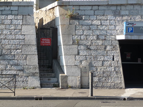
Explicit sign of (old) military urbanism. A military area in the heart of Marseille, as captured last week.
Posted: July 11th, 2010 | 1 Comment »
Back from pleasant Marseille where I participated to Lift France 10 with a talk on the exploitation of network data. Here are the slides and transcript:
Network data as material to shape urban strategies (7.3MB)
Besides great food, a laid-back atmosphere, and Lift, Marseille provides a fine terrain for urban safari.
Posted: June 28th, 2010 | No Comments »
In a week I will be in Marseilles, France to attend the Lift France 10 Conference that will focus on the interplay between network technologies and the future of manufacturing, learning, shaping cities and public policy. As usual the conference will aim at looking at the implications, the extend of the impact, the limitations, in other words in trying to grasp its full potential of technological and social evolutions.
I will contribute to the discussions with talk in the “Making sense of the world through shared data” them in the section “The New Science of Data”. My discourse will particularly aim at illustrating the exploitation of network data beyond their visualizations (see What Can Be Gained From This Data? and Below the Tip of the Urban Data Iceberg) with new types of research processes (see The Kind of Researcher I Am, The Rise of the Data Scientist and What is Data Science?) that lead to new opportunities to develop innovative services and solutions (see my most recent Lift Lab talk, Neighborhood Metrics, Detecting air travel to survey passengers on a worldwide scale and When a Real-Estate Platform Becomes an Urban Actor) with their potential potholes (see The Potholes in the Urban Information Landscape, The “Quants”, their Normalizations and their Abstractions, and Big Data: The Necessity of Mixed Methods) and ethical issues (see The Application and Management of Personal Electronic Information). Well, in other words, the summary goes like this:
Network data as material to shape urban strategies
Our constant interactions with network infrastructures generate data that aliment the integral function of services we use in our daily lives, for instance, when making a phone call, when withdrawing money, when using public transports or unlocking a Vélib bike. The accumulation of this massive amount of data constitute empirical and longitudinal evidences that help manage cities, their events, their mobility infrastructures and their buildings. As part of a new science of data, a blend of software engineers, statisticians, physicists, researchers, entrepreneurs and designers are working on processes that generate value from large amount of complex datasets with the prerequisite to protect individuals right to privacy. In this talk, I will provide examples on the exploitation of network data as material to measure occupancy levels and flows of crowds. With the capture of the pulse of space and the analysis of core samples it is possible to define indicators that help evaluate and shape the strategies of the different actors of the city (city councils, transportation companies, urban service providers, city planners and decision makers).
This year’s Lift France should be great. Besides enjoying France’s oldest and potential most futuristic city, Marseilles, I look forward to engaging with Matt Cottam, Stefana Broadbent, Manuel Lima, and many others.
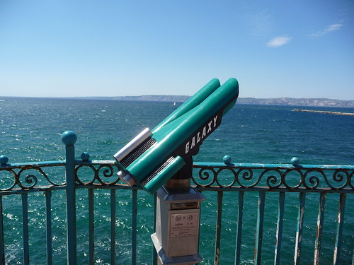
Yet another an apparatus for capturing other points of View: Marseilles’ GALAXY coin-operated binoculars.
Why do I blog this: A presentation at Lift is always an excellent opportunity to reframe and strengthen my discourse and formalize my approach.
Posted: June 24th, 2010 | No Comments »
Intriguing metrics in relation to our investigation on identifying and measuring urban design qualities: the JaneScore measures the features that make for a “healthy urban neighborhood”, as articulated by Jane Jacobs. Based on Matt Lerner’s Walkscore who works with Liz Dunn at the Preservation Green Lab, it focuses on capturing the diversity of a street. In McNeighborhood Dan Bertolet describes the key variable:
The key attribute is diversity. In my interpretation, the JaneScore would focus on measuring diversity in a wide range of elements, such as building width, height, condition, style, and age; commercial space use, size, and rent; housing unit type, cost, and tenant demographics. Metrics to rate the vitality of street life would help round out the score.
Jonathan Hiskes highlights the potentials of this metrics in Measuring neighborhood diversity and liveliness with ‘JaneScore’
Building JaneScore maps sounds more difficult than building Walk Score, which draws from Google data. But it would help separate gentrified neighborhoods from economically varied ones. It would separate squeaky clean new neighborhoods from more eclectic historic ones. If JaneScore gets built out, it could yield heaps of information about the various flavors of urban living, which has great potential (see also Walkability Generates Real Value) to be sustainable living.
Why do I blog this: Data are at the source of these new metrics to define streets and neighborhoods. Both Walkscore and JaneScore rely on the static geographic, building, parcel, and demographic information. We are curious in coupling dynamic data and qualitative observations to the definition of these kind of neighborhood metrics (see Exploiting the Bluetooth Spectrum as Material for Space Management Strategies).

The hardly measurable diversity and vitality of a street. Photo courtesy of Nicolas Nova.
Posted: June 7th, 2010 | No Comments »
MIT SENSEable City Lab‘s urban demos and beautiful visualizations have often overshadowed the research works produced behind the scene (see Below the Tip of the Urban Data Iceberg). The Network&Society project aims at presenting the lab’s different research agendas for understanding cities with investigation on urban traces, visualization tools, eigenplaces, public transportation, digital footprinting and urban gravity.
This constant stream of 0s and 1s allows unprecedented research opportunities. Through phone calls we can see cities making bold ‘handshakes’ during business hours, and then becoming introverted during the evening. With SMS texts, we capture crowds cheering and sharing their emotional highs in special events. These digital traces also reveal the migratory magnetism of coastal city hotspots and the drudgery of a gridlocked commute.
The ‘Network & Society’ project at the MIT Senseable City Lab employs these large-scale digital datasets to explore physical mobility, social networks and urban places.

Visualization of mobile phone users locations, points of interest and events in Boston, USA
Why do I blog this: Demos and beautiful visualizations are part of the practice of data science. But they should not overshadow the many research outcomes from the experience and data generated during these urban demos.
Posted: May 30th, 2010 | No Comments »
In the concluding chapter of my PhD thesis, I stepped back from the contributions and contemplated their implications. I entitled one section “From data-driven urbanism to human/data-based urbanism”, in which I set some of the limitations of my work:
However, there is a big assumption in seeing the world as consisting of bits of data that can be processed into information that then will naturally yield some value to people. Inspired by Julian’s *-computing. [...] the understanding of a city goes beyond logging machine states and events. In consequence, let us not confuse the development of novel maps from previously uncollectable and inaccessible data with the possibility to produce “intelligent maps”.
Taken this caution into account, I argue for the necessity to mix quantitative and qualitative data to build knowledge on a city/building/shared space, our relations with it and its infrastructures. Both types of data con feed inductive and deductive methods:
The qualitative analysis to inform the quantitative queries: This approach first focuses on people and their practices, without the assumption that something computational or data process is meant to fall out from that. This qualitative angle can then inform a quantitative analysis to generate more empirical evidences of a specific human behavior or pattern. [...]
The quantitative data mining to inform the qualitative enquiries: In that approach, the quantitative data help to reveal the emerging and abnormal behaviors, mainly raising questions. The qualitative angle then can help explaining phenomenon in situation. The qualitative approaches actually requests to ask the right questions to learn anything meaningful about a situation. [...]
So, I was particularly pleased with recent’s Big Data: Opportunities for Computational and Social Sciences in which Danah Boyd acknowledges the tremendous opportunities “Big data” creates in social sciences, but, analogously to my conclusion, she points out the limitations of computational scientists in the “web science” domain:
Just because you see traces of data doesn’t mean you always know the intention or cultural logic behind them. And just because you have a big N doesn’t mean that it’s representative or generalizable. Scott knows this, but too many people obsessed with Big Data don’t.
One major problem when it comes to “large archives of naturalistically-created behavioral data” is their “subjectivity” or the “hidden intentions” behind them (see “Embracing the Subjectivity of Georeferenced Photos“) or as Danah argues “Just because you see traces of data doesn’t mean you always know the intention or cultural logic behind them“. Grasping the value in subjective data is still a concept computational scientists must get the mind around, and I doubt they will be able to do alone in their research communities.
Besides data analysis methods, creativity comes to play in collecting both precise and relevant data for mixed methods. For our current investigation on hyper-congestion at the Louvre Museum, at a very early stage we thought of integrating observations of the surveillance team to help explain phenomena quantitative data analysis reveal.

A surveillance staff member as a source of information to explain phenomena quantitative data analysis reveal.
Why do I blog this: My PhD thesis taught me that patterns invite more questions than they answer. On the field, to answer questions, there is necessity to know how to mix quantitative with qualitative methods. So also The “Quants”, their Normalizations and their Abstractions.
Posted: May 30th, 2010 | No Comments »
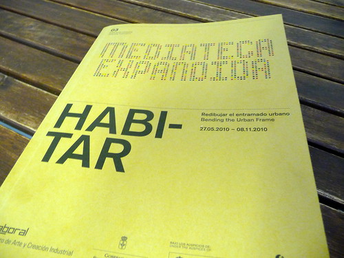
This week opened the HABITAR exhibition at LABoral Centro de Arte y Creación Industria as part of their Mediatica Expendida, a space dedicated to new forms of distribution and access to art. I had the please to contribute to this project as conceptual advisor collaborating with curator José Luis de Vicente to define a walk through emerging ideas, solutions, languages that define a new urban landscape. This walk showcases the creative process of artists, designers, engineers, hybrid researchers that now jostle with the practices of architects and city planners.
LABoral proved to provide the best support for an interdisciplinary forum for dialogue that foster this new urban framework. As described by Benjamin Weil, Chief Curator at LABoral: “The presentation of projects functions as a Demo, as a 3D documentary, and at times as a more classical exhibition. The experience of data is core to the curatorial premise, as a mean to reflect upon the notion of exhibition space“. The spatial designers Longo + Roldán proved particularly good at that game.
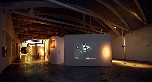
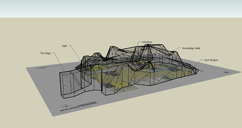
The HABITAR exhibition space at LABoral. Photo courtesy of Edgar Gonzalez
The journey into HABITAR starts with the account of the city as a built space that is increasingly being replaced by that of a set of dynamic processes and human flows superimposed onto its physical infrastructure. As architects move away from working with plans and towards working increasingly with words and narrative, their output is measured in terms of ideas more than structures. In addition, with physical infrastructures now complemented, governed and even replaced by information systems, new ideas, solutions, languages from different practices have emerged. From the 17 contributions exhibited, José Luis and I wanted to communicate some implications. Here is my perception with an attempt to categorize and link them.
The code altering people’s experience of the urban space
The wireless infrastructure subtly highlighted in Wireless in the World (2009) project fashions sentient and reactive environments through information layers that are integrated into the actual design of physical space. In Wi-Fi Structures and People Shapes (2009), the analyses of how the fluctuations of wireless signals can be mapped onto the informal use of space. The sketches reveal how users interact with the wireless space and elements like furniture that were provided for them as part of the investigation. These new forms of dwelling the space governed by ubiquitous computing and hyper-connectivity also produce counter-reactions with emerging defensive skills and solutions. Hacking public space therefore becomes an integral part of the way it is being used and is therefore mapped out. The Sentient City Survival Kit (2010) does a great job in raising the awareness of the implications for privacy, autonomy, trust and serendipity in this highly observant, ever-more efficient and over-coded city.
Wi-Fi Structures and People Shapes. Peaks indicate good signal strength; troughs indicate poor signal strength. Image courtesy of cityofsound.
Capturing and rendering the dynamics of the city
First, the vision of the city as a historical conglomerate of buildings and infrastructure is augmented with dynamic visions of the city that include its information networks, mobile technologies, the increasing mobility of citizens, and the presence of environmental parameters such as air quality, noise levels and stress factors. The exhibition features several of MIT SENSEable City Lab‘s pioneer works in the domains of space definition. Locutorio Colón (2005-2006) and Time Out of Place (2007), are examples form the worlds of designers and artists to captured and rendered mobilities with local and global relationships. These works reveal the necessity to further push the boundaries in the use of aesthetics as part of a collaborative research process Visualizing Lisbon’s Traffic (2010) (as part of the MIT Portugal research program) and engage on key issues such as In the Air (2008-2010).
The multiple points of view and angles of participation
Besides grasping and beautifying urban dynamics, projects aimed highlighting the multiple facets of one urban reality. For instance the researchers at MIT SENSEable City Lab developed prototypes to understand the “removal-chain” as the industry does for the “supply-chain”. Similarly, the Near Future Laboratory, shipped to Gijon their apparatus for capturing other points of view. This 24 foot pole was used in an experiment to visually describe time, movement, pace, scales of speed and degrees of slowness of flows in urban spaces. What strikes in these works is the diversity of angles of approaches of technological initiatives that relate to the urban life. The exhibition features the processes project conceived to encourage the creation, development and collaboration with an impact on the city. UrbanLabs “based on the philosophy and collaborative methods of free software, it brings together –on-site and online– a range of citizens, entrepreneurs and creative agents who are working on solutions and digital services in the field of communication, mobility, decision taking, geo-localisation, leisure, sustainability, cooperation and city planning“. Also from Spain, the BCNoids (2008-2010) project that reveals Barcelona from its Bicing system was developed by architecture students as part of the Visualizar workshop series at Media-Lab Prado.
24 foot pole was used with 2 recording cameras mounted on top of it, an urban scout equipment developed by the Near Future Laboratory. Photo courtesy of JulianBleecker.
Climate and its protection as architecture’s new terrains of investigation
These new angles of approach at the crossroads of geography, sociology, design, art and grassroots initiatives tend to redefine the way we can envision the city, its dynamics, its buildings and spaces. They try to take into account the new needs and preoccupations of today’s heterogeneous citizenship that share a common space and for Benjamin Weil to wonder “it is possible that the various experiments featured in Habitar demonstrate the limit of the modernist utopia“. The practice of architecture has been exploring new terrains such as investigating more uses or options to existing building’s design as featured in the Mutant Bridges (2010) project. Meteorological Architecture (2010) sets another goal of architecture to look for the balance with climate and its protection and suggests the possibility for for climate to become the resources and tools of architecture. Based on digital design and new technologies for customized fabrication, Fab Lab Solar House (2009-2010) is the first completely self-sufficient solar house in Barcelona.
Fab Lab Solar House at HABITAR. Photo courtesy of Edgard Gonzalez.
Why do I blog: Contributing as advisor and curating some aspects of the exhibition was a worthwhile experience to further grasp the role of architecture at the time of urban informatics. The HABITAR catalog includes 8 essays from the curator José Luis and I are particularly eager to share online. The contributors include Benjamin Weil, Molly Wright Steenson, Bryan Boyer, Usman Haque, Anne Galloway, Nicolas Nova and José Pérez de Lama. More on that later….
Table of contents of the HABITAR catalogue. More on that later….
Posted: May 26th, 2010 | No Comments »
Since Tracing the Visitor’s Eye, back in 2007, several projects have emerged with more stunning and large scale maps of georeferenced photos in Flickr, Picasa, Panoramio or Getty Images. Some visualize the density of photos to describe the spaces (e.g. World touristiness map, Mapping the Cultural Buzz, 24 Hours of Geotagged Photos) while other exploit the timestamp embedded in each photo EXIF to extract individual paths (e.g. Mapping the World’s Photos, Image Sequence Geolocation with Human Travel Priors), flows (e.g. The World’s Eyes) and even infer the mode of transportation (e.g. The Geotaggers’ World Atlas).

New York City from Eric Fischer‘s beautiful Geotaggers’ World Atlas.
These works display the enormous creative skills and sense of aesthetics of their developers. In a pure “urban demo” approach, their storytelling power serves as alibi to attract attention, stimulate the dialogue and stretch the imagination (see Below the Tip of the Urban Data Iceberg).
Yet, a second generation of exploration of these georeferenced photos has yet to take place; the type of investigation that creates value and knowledge beyond a pure narrative and the fascination of beautiful visualizations. I explain this slow evolution to extract ourselves from.
First, some of the narratives describing these projects aim for objectivity rather than fully embracing the subjectivity of the data. In my research work, I considered that uploading, tagging and disclosing the location of a photo was an act of communication rather than a pure implicit history of physical presence. Therefore, these data are not comparable to absolute values of the presence of photographers and tourists as it is easy and useful to narrate with these visualizations. Rather, the data give indications about the places/events/environments web-sharing platform like sharing. An example of knowledge extraction from georeferenced data is Neighborhood Boundaries by Tom Taylor that exploit Flickr Shapefiles to define neighborhoods from human perceptions.
Second, these works do not place under scrutiny the evolution of subjective layers or digital strata accumulated over the last years. When samples are extracted, cleaned, normalized and analyzed, they can give indications on the evolution of places/events/environments. Our work in the Summer 2008 around the NYC Waterfalls come to my mind to exemplify the value of temporal layers (see Quantifying urban attractiveness from the distribution and density of digital footprints). In this work, we compared over 3 years the flows photographers present in lower Manhattan. With a centrality indicator, we could reveal that the year of the Waterfalls, the waterfront became more central in the routes based on what photographers like to share. This work delivered a quantifiable indicator to evaluate an urban strategy extracted from a subjective dataset.
Why do I blog this: Noticing a surge of new visualizations of georeferenced photos, when the moment might have come to produce a new generation of investigation, to create and share knowledge out of theses masses of data. It will be the theme of the upcoming Lift France 10. The ability to attract the attention with visualizations is part of the new data scientist skillset. On the other hand, grasping the value in subjective data is still a concept we must get our mind around. To be discussed at Lift in Marseille.
Posted: May 20th, 2010 | No Comments »
Today, I participated to the 12th edition of the BDigital Global Congress in a session on “Smart” Cities. As I genuinely believe that cities are by definition “smart”, I had no conceptual models to propose. Nevertheless, in a brief talk, I intended to communicate notions that I am more comfortable with; focusing on details rather than big pictures. My message crystalized on the opportunity to exploit the data soft infrastructures produce. In the recent years, a first generation of projects mapped network data to raise awareness on city dynamics. At Lift Lab, we are conducting a second generation of investigation that further exploits the value of these data. We are devoting our attention to the production of metrics and indicators from network data. To explain our approach, I presented two case studies that examplify how indicators can integrate space management strategies (assess strategies in New York) and tackle some frustrations of daily life (indicators that measure the hyper-congestion in the Louvre Museum).
Download the slides + notes.

Why do I blog this: This congress was an opportunity to confront some of our maturing concepts on indicators and collect feedback on their implications and applications.