Posted: November 10th, 2006 | No Comments »
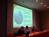
From m-Location presentation UK Mobile Phone Location Technology – The Current Status at the Royal Institute of Navigation Forum – Conventry in May 2004
GSM cell coverage (in reality)

Area of uncertainty for Cell ID positioning

Approximate GSM cell boundaries

Accuracy and maps

Relation to my thesis: Gathering visualizations of issues with mobile phone location technologies
Posted: November 9th, 2006 | No Comments »
Current Local Positioning Systems Newsletter offers an overview of the ICiNG Location Client. ICiNG (Innovative Cities for Next Generation) is a european project that develops the concept of a “thin-skinned City”. That is a city that will be sensitive to both the citizen and the environment through the use of mobile devices, universal access gateways, social software and environmental sensors. Currently, Dublin, Barcelona and Helsinki to act as “city laboratories” for researching, evaluating and demonstrating technologies and services using intelligence in the environment.
ICiNG Location Client will use a fusion of methods of determining a mobile devices location. This article gives an overview on how the client will work in general with the considered location-based technologies and approaches.

Relation to my thesis: I am currently (unfortunately) only remotely related to the ICiNG Project. I am interested in their approach of urban mobility data collection and how these information can be delivered back to citizens. In this project “lingo” is is called
- Location Based Services that interact with the citizen and the environment
- ‘Urban Mediator’ system for citizen-led services Research-Based Evidence of community use
Posted: November 9th, 2006 | No Comments »
Last night’s MobileMonday Barcelona on Proximity Marketing was the occasion to get briefed on the present real-world cases of mobile technologies used in a physical context. FuturLink presented their (rather impressive) content delivery system based on Bluetooth access points; Media Contacts talked about tailoring content; and Nike related on their (mostly) good experience on using proximity marketing; finally Daem Interactive revealed their MMS image recognition solution.
Some of the case studies mentioned still approach a mobile phone as a mix of TV set and physical mailbox into which it is ok to slip ads. Apparently it works in some cases (airport, big ad signs, in front of a store). However, I am sure there are more engaging/viral scenarios to deliver for the “customer” in the domain of proximity marketing. I’ll keep an eye on FuturLink and their upcoming? use of NFC-based solutions.
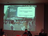
From left to right: FuturLink’s Bluetooth Access Point, Nike’s proximity experiment on a big Nadal ad in Barcelona, Media Contacts’ new generations of content.
Relation to my thesis: The early real-world solutions for the masses of mobile interaction with the physical.
Posted: November 7th, 2006 | No Comments »
A mobile office?
Posted: November 1st, 2006 | No Comments »
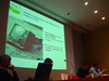
Macrofocus has released the InfoScope v. 3.0.7 that comes with 2006 “Prices and Earnings around the Globe” dataset. The InfoScope is an interactive visualization system that supports analysis and exploration of a large number of indicators in complex datasets. The Prices and Earnings around the Globe dataset contains information about the purchasing power in almost 60 cities around the world. Each city is characterized by more than 100 different attributes such as the price for food, salary of engineers or the working time required to buy a hamburger.

Relation to my thesis: The InfoScope uses multiple coordinated views to analyze geo-referenced datasets. An article explains this approach:
Brodbeck, D. and Girardin, L. 2003. Design Study: Using Multiple Coordinated Views to Analyze Geo-referenced High-dimensional Datasets. In Proceedings of the Conference on Coordinated and Multiple Views in Exploratory Visualization (July 15 – 15, 2003). CMV. IEEE Computer Society, Washington, DC, 104.
It uses several interesting visualization techniques I could think of applying:
Fisheye view

A fisheye view of the world focused on Europe. Highlighted objects in the periphery remain visible.
Similarity map

Similarity maps help to gain an overview of the global relationships between objects: cities are placed on a map so that similar cities are located close to each other and dissimilar ones far apart.
Parallel coordinates view

The parallel coordinates view shows one axis for each attribute or criterion that characterizes the cities. Connecting the actual values for one specific city on all the axes leads to a polygonal line that forms a visual representation of the characteristics of this city.
Posted: November 1st, 2006 | No Comments »
The Laboratory for Ubiquitous Computing and Interaction at UC Irvine released the first version of a UbiComp reading list. This reading list is necessary for graduate students advancement to candidacy.
Relation to my thesis: keeping track on my literature review. I spotted a Hightower-Borriello article I was not aware of:
Hightower, J. Brumitt, B. and Borriello, G. 2002. The Location Stack: A Layered Model for Location in Ubiquitous Computing. Proc. of the Fourth IEEE Workshop on Mobile Computing Systems and Applications, IEEE Computer Society.
Based on five design principles extracted from a survey of location systems, they present the Location Stack, a layered software engineering model for location in ubiquitous computing.

In the future work section, they mention the challenge of uncertainty representation:
While it is clear that representing the precise nature of a sensor’s measurement uncertainty is critical, a general mechanism for this remains elusive. Traditional Gaussian representations [18] suffer from problems with nonlinear transformation between coordinate frames and the scalability of particle filters to large domains remains a challenge, although scalable state estimation techniques used in mobile robotics [8] are an excellent place to start and are the approach taken by our reference implementation.


