Posted: August 25th, 2006 | No Comments »
Stankiewicz, B.J., Legge, G. E., Mansfield, J. S., & Schlicht, E. J. (2006). Lost in Virtual Space: Studies in Human and Ideal Spatial Navigation. In Press. Journal of Experimenal Psychology: Human Perception & Performance. 32(3), 688-704.
An internal representation of the space is usually referred to as a cognitive map. To develop an understanding of human spatial navigation, it is important to understand how the cognitive map is developed and the nature of its representation. This paper describes three human spatial navigation experiments that investigate how limitations of perception, memory, uncertainty and decision strategy affect human spatial navigation. The authors present a model designed to navigate through visual sparse indoor environments that contain perceptual ambiguity. First experiment found that participants’ way finding efficiency decreased as layout size increased. Experiment 2 investigated whether this reduction in navigation efficiency was due to visual perception. Experiment 3 investigated if it was due to memory, spatial updating strategy, or decision strategy. Results suggest that the inefficiency in Experiment 1 is due to inefficiency in the participant’s spatial updating strategy.
The key properties of the model’s spatial navigation task are:
- Perception: perceptual input like two-dimensional and stereo depth visual images, auditory cues, kinesthetic feedback from joints and muscles
- Spatial updating: ability to determine our location and heading in a large-scale space given our knowledge about the environment (cognitive map) and the sequence of specific observations and actions while navigating.
- Decision strategy: set of actions to move from one state in the environment to another.
- Navigation goal: to formalize a spatial navigation task one needs to specify the goal. The most common spatial navigation goal is to travel from one known location to another known location.
These properties are used to investigate where the cognitive limitations might exist in spatial navigation. Experiment 3 might be the most related to my research because it deals with give supplementary information made available to the participant. It had three conditions, No-Map, Map and Map + Belief Vector.

Findings of experiment 3 suggest that participants did not have difficulty in accessing their cognitive map, or that the global information afforded by the supplementary map was not useful to them. Future research will investigate the contribution on navigating behavior when navigating with uncertainty of:
- accurately updating a belief vector given an action
- generating the candidate states given an observation
- accurately updating a belief vector given an action
- accurately eliminating candidate states given the current observation
In the discussion, the author mention navigating with uncertainty:
The present studies suggest that participants have difficulty navigating when there is state uncertainty. The three experiments show that the major factor in participants’ inefficient navigation behavior lies in the methods they use to update their belief vector. Within this updating procedure, there are four specific procedures; any one of them, or a combination of inefficient processing, can lead to the inefficient behaviors found in the present experiments. These subprocesses include the following: (a) generate all of the states that are consistent with the current observation, (b) remember the candidate states, (c) update this collection of states on the basis of the most recent action; and (d) eliminate the candidate states that are inconsistent with the current view. Any or all of these processes may have produced the inefficient behavior found in these studies.
Relation to my thesis: Maps and location-aware systems are mediums to help create and update cognitive maps of physical/virtual spaces. Here I am digging into spatial navigation and spatial cognition. Spatial navigation is composed of multiple processes that include perception, memory, spatial updating and decision making. This study investigate our navigating skills when there is uncertainty about our current state in the environment and their is very visual information to reduce the ambiguity. The paper describes well how the psycho experiment was run. That is observing and then testing hypothesis with different conditions. The authors use desktop virtual to investigate way-finding behavior. The question is if the results will actually generalize to navigation under more realistic conditions. It would be good to find references on such spatial navigation/cognition experiments in real-world settings. The paper bring several useful concepts such as:
- Perceptual ambiguity
- Cognitive map (Hirtle and Heidorn 1993; Kuipers, 2001; O’Keefe & Nadel, 1978; Tolman, 1948). The concept of a cognitive map has influenced how researchers describe the ultimate representation that we obtain after extensive exploration of a large-scale space.
- Belief vector, the list of states that the participan could be in given their previous observations and actions.
Posted: August 23rd, 2006 | No Comments »
Samer Karam, Sukeshini A. Grandhi, Quentin Jones, Loren Terveen and Steve Whittaker. Putting Systems into Place: A Study of Design Requirements for Location-Aware Community Systems. Poster at UbiComp04
A poster to present a conceptual framework on how socially-defined places influence people’s information sharing and communication needs. The authors argue that system design must factor in userrs’ activities and social networks, alongside place. They present the P3-Systems conceptual framework organizes the design space and location-aware systems into mainly People-Centered and Place-Centered systems. People-Centered systems employ user location to support awareness, while Place-Centered systems link virtual spaces to physical locations.

From the findings of the study some implication for design can be extracted:
- Place alone does not determine information needs; user routines and social relationships must be integrated
- While people are willing, to share their location information with others, for a seamless user experience the relationships between users, places, and their social networks will have to be simultaneously taken into account.
A full paper was later published:
Jones, Q., Grandhi, S. A., Whittaker, S., Chivakula, K., and Terveen, L. 2004. Putting systems into place: a qualitative study of design requirements for location-aware community systems. In Proceedings of the 2004 ACM Conference on Computer Supported Cooperative Work (Chicago, Illinois, USA, November 06 – 10, 2004). CSCW ’04. ACM Press, New York, NY, 202-211.
Relation to my thesis: Study on the type users’ social networks and activity beyond place as determinant location information. I inspired myself from the people/place-centered distinction of location-aware systems for UbiComp06. The authors also categories location-aware systems accoding to absolute/relative positioning, user activity/virtual space, and synchronous and asynchronous
The here a reference to Context-Aware Experience Life Sampling Methods (CAES) that I should dig into to run my second experiment:
Intille, S. S., Tapia, E. M., Rondoni, J., Beaufin, J., Kukla, C., Agarwal, S., Bao, L., and Larson, K., (2003). Tools for Studying Behavior and Technology in Natural Settings. UbiComp 2003.
as well as:
Jones, Q., Grandhi, S. A., Whittaker, S., Chivakula, K., and Terveen, L. 2004. Putting systems into place: a qualitative study of design requirements for location-aware community systems. In Proceedings of the 2004 ACM Conference on Computer Supported Cooperative Work (Chicago, Illinois, USA, November 06 – 10, 2004). CSCW ’04. ACM Press, New York, NY, 202-211.
Posted: August 21st, 2006 | No Comments »


Posted: August 21st, 2006 | No Comments »
Very similar to Place Lab, Intel Reseach’s POLS is a Privacy Observant Location System that provides an easy to use, on-device localization solution for mobile application developers. During the development of POLS, a large set of cell data for the Seattle Metro area was collected. The map below shows the coverage area. The combination of this data and the POLS software give a complete working location system within the coverage area.

POLS currently supports phones based on the HTC Typhoon series phone (Audiovox SMT 5600, Orange SPV C500, UTStarcom SMT 5600, I-Mate SP3/SP3i, QTEK 8010/8020, Dopod 565, MoviStar TSM 520, O2 Xphone II
T-Mobile SDA.
Relation to my thesis: Planning second experiment
Posted: August 21st, 2006 | No Comments »
At the Ubicomp06 conference, I’ll be greatly interested in Wednesday’s sessions including: Where Are We Going?, Games as Platforms, and Using Ubicomp For Real. Key full papers related to my work are:
Mobility Detection Using Everyday GSM Traces
Timothy Sohn (University of California, San Diego, US); Alex Varshavsky (University of Toronto, CA); Anthony LaMarca (Intel Research Seattle, US); Mike Chen (Intel Research Seattle, US); Tanzeem Choudhury (Intel Research Seattle, US); Ian Smith (Intel Research Seattle, US); Sunny Consolvo (Intel Research Seattle, US); William Griswold (UC San Diego, US)
Practical Metropolitan-scale Positioning for GSM Phones
Mike Chen (Intel Research Seattle, US); Timothy Sohn (University of California, San Diego, US); Dmitri Chmelev (University of Washington, US); Dirk Haehnel (Intel Research Seattle, US); Jeffrey Hightower (Intel Research Seattle, US); Jeff Hughes (University of Washington, US); Anthony LaMarca (Intel Research Seattle, US); Fred Potter (University of Washington, US); Ian Smith (Intel Research Seattle, US)
Hitchers: Designing for Cellular Positioning
Adam Drozd (University of Nottingham, UK); Steve Benford (University of Nottingham, UK); Alan Chamberlain (University of Nottingham, UK); Michael Wright (University of Nottingham, UK); Nick Tandavanitj (Blast Theory, UK)
Posted: August 18th, 2006 | 1 Comment »
I have been playing around a couple of mobile software instantiating ubicomp brick enabling information ubiquity. The concepts they carry are of interest for the second experiment I am planning.
The Nokia Mobile Web Server is truly groundbreaking. Putting Internet accessible servers (web or others) on mobile devices changes the mobile information flow and is a clear step forward an Internet of things. Contextual data can be both pushed and pulled. [my previous post on this]. Source code is available on sourceforge.


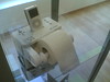
A mobile web site, Netscape Gold era style (right). Mobile Apache Server administration and logs
Jaiku is a real-time “rich presence” mobile phone (S60) applications. The authors mention “Rich presence” as the description of the many relevant things a phone knows about a users. Rich presence on Jaiku includes an IM-style away line, your phone profile (ring volume, vibrate), location (country, city/region, neigborhood), Bluetooth devices around, upcoming calendar events, and the duration how long your phone has been idle. Jaiku integrates “all in one” a couple of location technologies (GPS, GSM, BT) and carries the senses of relative and absolute positioning for location awareness.


A rather poor “reach presence”.
The Kaywa reader reads QR codes and as well as datamatrix. The Kaywa QR code generator allows to create a QR code linked to different content (url, sms, text, phone number). Semacodes and such are leaving the reasearch labs and entering the mobile industry’s near-field communication concepts.


Posted: August 11th, 2006 | No Comments »
J. Randall, O. Amft, G. Tröster, “Towards LuxTrace : using solar cells to measure distance indoors“, LoCA 2005, T Strang & C. Linnhoff-Popien editors, p.40-51.
A paper on a location system that is based on solar modules for navigation and tracking of humans within a building. The concept, LuxTrace, relies on existing infrastructure and proves to be low cost, low weight, low volume and manufactured to have similar characteristics to everyday clothing. The solar modules are used only to track the intensity of indoor lights as a form of context information.

The authors provide an interesting theoretical framework with 2 papers that were not my radar yet:
On Markov localization:
Fox, D.: Markov Localization: A Probabilistic Framework for Mobile Robot Localization and Navigation. PhD thesis, Institute of Computer Science TU Dreseden Germany (1998)
and some early Hightower work providing a taxonomy of location systems:
Hightower, J., Borriello, G.: A survey and taxonomy of location systems for ubiquitous computing. IEEE Computer, 34(8) (2001) 57–66
Relation to my thesis: One type of alternative location technique (as opposed to the mainstream GPS, RF-based) that could very much fit to very specific environments and scenarios. A must be aware on the way the compute their average distance estimation error (less than 18cm with a confidence of 83%)
Posted: August 11th, 2006 | No Comments »
Evan Welbourne, Jonathan Lester, Anthony LaMarca, Gaetano Borriello: Mobile Context Inference Using Low-Cost Sensors. LoCA 2005: 254-263.
This paper reports on the fusion of location and non-location sensors data to leverage the synergy between them to enable a wider variety of high-level mobile context inference. The system senses location with a GSM cell phone and a Wi-Fi enabled mobile device (each running Place Lab), and collects additional sensor data using a sensor board that contains an 3-axis digital accelerometers, barometric pressure, analog visible light phototransistor, digital barometer/temperature, relative humidity, 2-axis digital compass, analog electric microphone. The authors show that like previous systems, their system can classify a mode of transit and extract significant places within a user’s daily movements. However, their can do it without the use of GPS (unlike other experiments) and can classify places based on the activity that occurs there.
In Section 3, the authors mention the “experience sampling method” (ESM). After checking Context-Aware Experience Sampling Tool, it appears that in ESM:
Subjects are asked to carry a beeper device that signals on a time-based protocol determined by the researcher. Each time the beeper activates, subjects fill out a survey that typically includes questions asking what the subject was doing and how the subject was feeling at the time of the alarm. With a sufficient number of subjects and samples, a statistical model of activities can be generated. ESM is less susceptible to subject recall errors than other self-report feedback elicitation methods.
Future work in the fuse of location and activity and in mobile context inference include:
- infer the mode of transit to select an appropriate motion model for a location particle filter and improve the location accuracy
- work with place and indoor activity (e.g. mobile place such as bus and train)
- Collect users daily life data and annoted them with the ESM. It could be used to study the effects of place and activity on interruptability and prompting.
Relation to my thesis: It is an example of the fusion of location and non-location sensors to frame the activity of users. I am involved in a project using ESM and might inspire from it for my second experiment.