The Other Points of View
Posted: August 12th, 2009 | No Comments »In the concluding chapter of my dissertation, I discuss the value of multiple points of view to understand an urban environment and people practices. My work shows that the increasing availability of soft infrastructure improves the collection of longitudinal observations and the emergence of evidences from the statistical relations with variables (e.g. What is the effect of new physical layout on movement?).
However, my work also suggests that there is a big assumption in seeing the world as consisting of bits of data that can be processed into information that then will naturally yield some value to people (see data-driven urbanism). For instance, in my study of the Manhattan waterfront, the data stays blind to inform on the ways people used the space. It is evident that the understanding of a city goes beyond logging machine states and events. Therefore, the “data-scientist” fascination of the massive amount of data cities produces in “real-time”, should not discard the other points of view necessary to understand the multiple uses of the city and its space over time. For instance, the legacy of William H. Whyte and his careful observation of use and appropriation of the space (watch for instance the intro of the The Social Life of Small Urban Spaces video) attests the invaluable virtue of qualitative analysis. Other points of views scrutiny the time-space relationships in the form of “chronotopic studies” (e.g. Etude Chronotopique de Pigalle) valuable to practitioners such as the Bureau des temps in Paris that focuses on improving of the “rhythm” of the city.
More than ever, there seems to be a real opportunity to collocate these multiple points of view around a practice that mixes quantitative data analysis with qualitative observations employed by Whyte. This combination of observational techniques has been mainly explored to understand the use of mobile technologies. For instance Matthew Chalmers’ Sumgroup has been developing analysis tools mixing video recording, and system-based techniques that log the technologies in use (see Recording and Understanding Mobile People and Mobile Technology and Andy Crabtree’s Digital Records for e-Social Science). Besides the challenge of synchronizing the points of view, there are numerous (physical, political, technological, ethical) constrains that prevent from capturing the proper angle from carefully chosen vantage points. One solution comes from the alternative, non-traditional, ways of seeing the world around us. Julian Bleecker’s latest Apparatus for Capturing Other Points of View is an example of new angles to observe and perhaps produce useful insights. Beyond the traditional “video annotations”, there are plenty of opportunities for the post-processing stages of the activity. Julian suggests some “explorations of ways in which individuals or small groups of people in movement could become their own producers of representations of what they do, in an aesthetic sense“. Other researchers look at video post-precessing to improve their city dynamics models object detection and space-time trajectory estimation (see Tracking Pedestrians).
What becomes intriguing with the couplings between the analytic data and the observed activities of people is the ability to superpose the top-down-city-as-a-system with the bottom-up-people-actions; in other words unveil how people appropriate, hack, desert the space according to its layout, design or regulations. The application of qualitative/quantitative, traditional/alternative points of view would mean a shift in the urban design and planning practices from the speculative predictions and accommodation to more factual observations and improvements addressing local needs. In the conclusion of my dissertation I explicit the interplay of the different points of view:
The qualitative analysis to inform the quantitative queries: This approach first focuses on people and their practices, without the assumption that something computational or data process is meant to fall out from that. This qualitative angle can then inform a quantitative analysis to generate more empirical evidences of a specific human behavior or pattern. A few approaches in that domain address this perspective. Williams et al (2008) for instance argue that our understanding of the city could benefit from a situated analysis of individual experiences within cities, rather than taking particular urban forms as a starting point for the study of urban experience.
The quantitative data mining to inform the qualitative enquiries: In that approach, the quantitative data help to reveal the emerging and abnormal behaviors, mainly raising questions. The qualitative angle then can help explaining phenomenon in situation. The qualitative approaches actually requests to ask the right questions to learn anything meaningful about a situation.
An example of the latter could have been applied to the context of the impact of the New York City Waterfalls (Chapter 6). We used digital footprints to reveal the variations in spatial presence and abnormal patterns of temporal presence over the course of a 2 years period. In addition to this quantitative analysis we could have performed qualitative observation on the detected areas to reveal how the attractiveness evolves (e.g. Do people stay longer?).
This fosters the need for research and practitioners to develop a coherent understanding of the traces of the activity: both qualitative (e.g. audio and video recordings of action and interviews) and quantitative (e,g. logfiles). With significant data on actual use of the space, we can perform new types of “Post-Occupancy Evaluations” often overlooked in the practice of urban design and architecture (Brand, 1995).
Why do I blog this: For a current project, I am exploring the multiple points of view to capture city dynamics. It starts by including citizen to elicit and describe the local dynamics and needs to feed the data analysis process of their city. They can create their own point of view with the ability to observe and capture their environment. This potential to capture, observe and replay the city echoes very well with the recent interest of some architects, urban planners and designers in unconventional data sources (e.g. beyond traditional surveys). But how does it integrate into the current practice? Is there a spot for some vernacularism? How can urban scouts and urban safaris communicate with practitioners and decision makers? See also Marcus Foth who uses participation and visualisation features to assist narrative generation and make transparent how users understand and interpret proposed urban designs (The Second Life of urban planning? Using NeoGeography tools for community engagement).
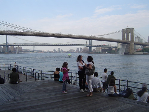
My study of the NYC Waterfalls (see Digital footprints as evidences of urban attractiveness) originally aimed at augmenting the data mining with situational observations at the key vantage points. The evolution of the attractiveness of a space also relates to the behaviors of visitors of the spaces. For instance the evolution of the types of groups visiting or What do they do when then stay?