


3.3 Landscape representation
For this purpose, we can model the visualization medium, for a RGB color model,[13] as composed of three planes. Each plane corresponds to one color channel, i.e. the red, green and blue channels, which control the intensity of each color. Then, for a 2.5-dimensional[14] representation, we can assign, for example, to a visualization media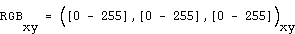
the following values: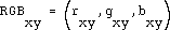
with  ,
,  , and
, and  being
being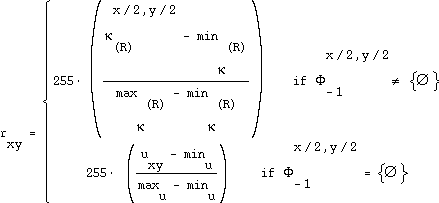 ,
,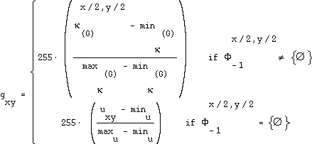 ,
,
where  denotes the number of links of the resources represented on a given pixel, thus
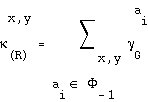 ,
, the number of resources represented on a single pixel:
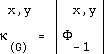 ,
,
and  an empirically determined value corresponding to the directory level found in the URLs.